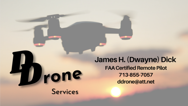

About Us
James H {Dwayne} Dick
Certified-FAA Part 107 Remote Pilot
With almost 50 years of mapping experince in various areas and more than 30 years of GIS experience with Shell Oil Company, I've started a new venture combining the two with my drone experience. We were using some drone contractors at work, but none internally due to Shell Aviation and legal concerns. My wife and I are retired and doing our little part of staying busy and working to supplement our income. There are many certified remote pilots (Part 107) that are available to do all kinds of drone work i.e. real estate, weddings, insurance and even mapping. High-end mapping using GCPs and survey drones can be quite expensive. I bring a low-cost alternative using just GPS of the drone. It's not as accurate but close enough to get a very good idea what your property being mapped looks like. Looking at the DTM (Digital Terrain Model) will give you an idea where to build, put your driveway by looking at the elevation. We can also help with those wildlife map documents, when filing your yearly reports. I fly the drones and my wife of 40 years, handles other chores of running a small business. We bought our property in 2020 in Rio Escondido (Evant, Tx.) and can help my Rio Family with your needs. I'm a Certified FAA Remote Pilot now but have been flying drones since 2018 and love it.